
Surveys and abundance
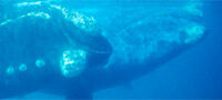
Since 1978 the International Whaling Commission has been counting whales in the Southern Ocean for management and conservation purposes with a particular focus on Antarctic minke whales. Each year ships survey about one tenth of the Southern Ocean up to the edge of the pack ice thus obtaining an estimate of the abundance of minke whales around Antarctica once every ten years.
Surveys over the past two decades suggest that there has been a significant decline in minke whale abundance but debate remains over whether the decline is genuine or an artifact of the survey technique. One theory is that changes in the ice-edge boundary each year, and changes in the number of minke whales present within the pack ice could be responsible for the changes in the number of whales seen in the open water. In other words, could more minke whales be hiding within the hundreds of kilometres of pack ice (and open areas within the pack ice), where the ships cannot search?
Unstrengthened ships cannot penetrate the ice and the noise of ice-breakers would affect the distribution of whales – this problem led to the idea that perhaps the best way to study minke whales in ice is from the air!
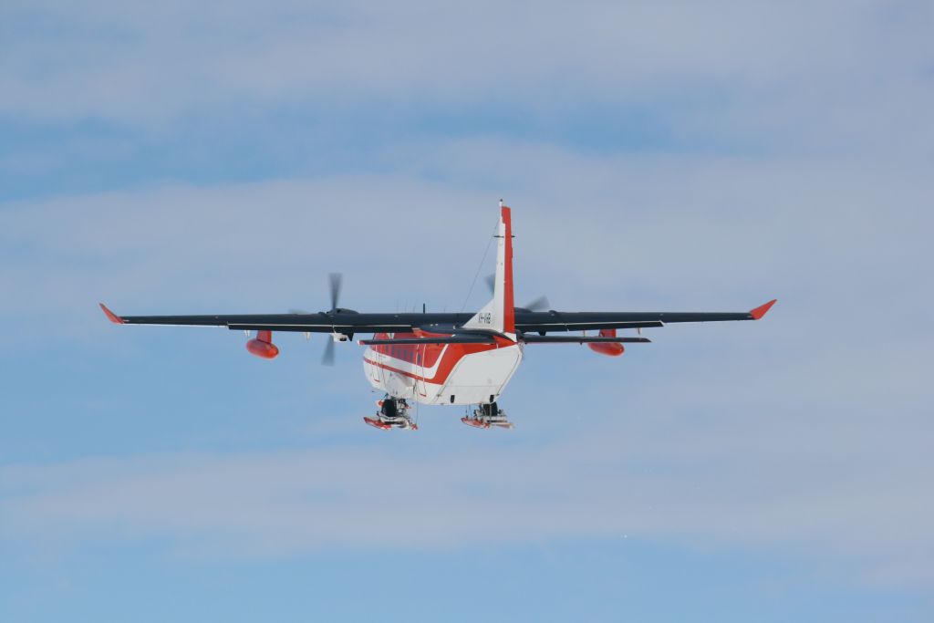
To test the theory, the Australian Antarctic Division started an aerial survey program to study the minke whales in the pack ice and their use of various pack-ice habitats. The platform selected for the survey was a CASA 212-400, a twin turboprop military transport aircraft, which can accommodate a team of four observers and a flight leader; known informally as 'Team Minke'. High-definition video cameras, a high-resolution digital stills camera and an infrared camera were installed in the base of the aircraft to detect whales hidden from view and to collect data on pack-ice habitat.
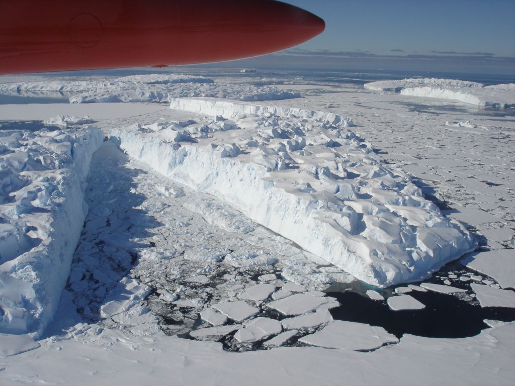
The aerial survey program has been running now for two summer seasons. The 2007/08 season tested the concept of flying aerial surveys using the CASA-212 aircraft from an Australian Antarctic station. In the second season (2008/09) a full survey was conducted over Vincennes Bay near Casey station in eastern Antarctica (66º 17′ S 110º 32′ E). During this survey many whales were seen by the observers and detected with the various cameras.
The CASA-212s have proved to be a suitable platform for surveys of minke whales in Antarctic pack ice in addition to their main role as transport for people and cargo between Australian Antarctic stations.
We are now confident that our new approach will assist in improving our ability to estimate the true abundance of minke whales around Antarctica.
This research is led by Natalie Kelly, David Peel and Mark Bravington.